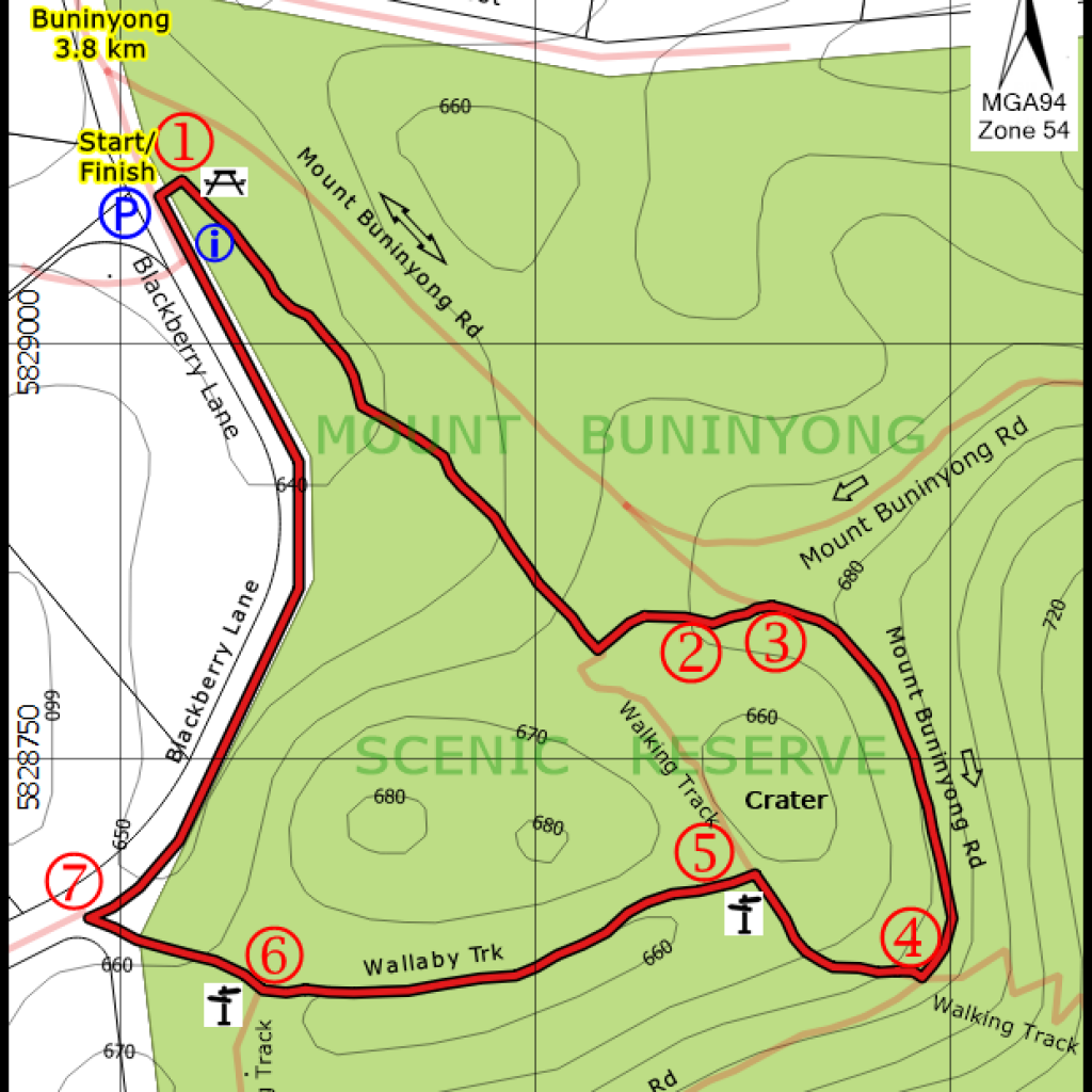
WALK DETAILS
Walk Distance: 1.9 km
Difficulty Level: Easy-Medium
Estimated Time: 40-50 minutes
Co-ordinates of Start/Finish Point:
E 757530 N 5829090
POINTS OF INTEREST
1. Blackberry Lane Picnic Area
2. Old Water Tank & Trough
3. Mt Buninyong Up Road
4. Crater Viewing Platform
5. First South Walk Sign
6. Second South Walk Sign
7. Blackberry Lane
Mt Buninyong was named after the Wathawurrung Aboriginal Warrior, Bun-a-yung. During a fight he was speared in the side and was mortally wounded and he lay down on his back with one knee up and died. The literal meaning of Buninyong is, “ a man on his back with a knee in the drawn up”. Where he was speared in the side forms the crater of Mt. Buninyong, an extinct volcano 745 m above seas level. The area was declared a Public Reserve in 1866 though grazing did not cease until the early 1960s
Parking for only 6 cars only is at the top end of Blackberry Lane on the boundary of the Mt Buninyong Scenic Reserve. A list of plant species in the Reserve is on the Buninyong Walks Web Site.
This Crater Walk differs from the one signposted. The start of the walk is 100 m from the Car Park. When arriving at the T-Junction, turn left then right when it meets the up road. Be careful of traffic. At the Crater Viewing Platform [4] you walk down the steps and follow the Zigzag Track to the signpost [5]. Here you turn left as indicated by the South Walk sign. Keep on this track past the second South Walk Sign [6] until you reach Blackberry Lane [7], turn right and walk along Blackberry Lane back to the Car Park.